Difference Between Plane Surveying and Geodetic Surveying
Table of Contents
Definition of Plane Surveying
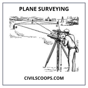
The Plane surveying is defined as a survey technique wherein the Earth’s surface is considered to be flat as well as the curvature of the Earth is neglected.
The plane measurements cover just a small distance, as well as the lines joining every two points, mainly on the Earth’s surface, are viewed as straight lines, with the angles between them regarded as plane angles.
Information on plane geometry, trigonometry is needed when working with plane surveys. Plane surveys covering an area of up to 260Km2 can be considered. It is worth noting that the length differential between the arc as well as the subtended chord on the Earth’s surface is just 0.1 m for a span of 18.2 km.
Definition of Geodetic Surveying
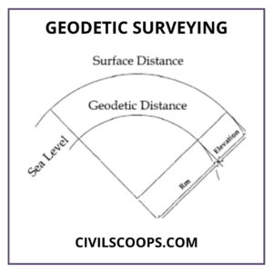
Geodetic surveying is a method of surveying that takes into account the curvature or spherical structure of the Earth. Geodetic provides the precise coordinates of points obtained by plane surveying. The country’s survey agency conducts geodetic surveys. That is the kind of surveying that takes into account the Earth’s curved shape.
The aim of a geodetic survey is to decide the precise location on the Earth’s surface of a network of widely separated points that serve as control stations for less precise surveys.
A curved line is defined as a line connecting two points, and angles are supposed to be spherical angles. If the field reaches 250
Km2, it is carried out. Geodetic surveying involves the selection of two stations (points) that are separated by a significant distance.
These two points’ latitude and longitude are calculated by astronomy. The line connecting these two points is known as the baseline, and it is precisely determined.
The angle formed by each end of the baseline defines the location of a third station. The entire procedure is referred to as triangulation. It is repeated until all of the surveyed lands have been mapped.
Objectives of Plane Surveying
- Plane surveys are performed on a broad enough scale for infrastructure programs to assess the relative locations of particular features on the Earth’s surface.
- Plane surveys are used in the design of roads, railways, and canals, as well as in the installation of boundary pillars and the building of bridges and factories.
- Plane surveys have a wide range of applications.
- Plane surveying is the first step in the execution of the bulk of engineering projects.
- Plane surveys are fundamental to the correct, cost-effective, and precise planning of all engineering projects, and their functional importance cannot be overstated.
Objectives of Geodetic Surveying
- The primary goal of geodetic surveying is to establish the exact location of remote points on the Earth’s surface.
- Engineers need reconnaissance knowledge and preliminary data to choose appropriate routes and locations to create effective structural designs.
- To create a set of reference points in order to identify specific locations.
- Setting stakes or otherwise marking lines, grades, and theory points, as well as providing technical assistance to direct building forces.
- To prepare progress reports, building products must be measured on-site.
- Dimensioning systems for the planning of as-built plans.
- To detect settlement, pre-installed targets on homes, foundations, pavements, and embankments, among other things, are used.
- To keep an eye on the ongoing building project 24 hours a day, seven days a week, in order to prevent mishaps.
- To keep track of structural deformations such as bridges, tunnels, and homes.
- To ensure the preservation of the properties next to the construction site.
Features of Plane Surveying
- The line connecting two points on Earth is called straight in plane surveying. Consider two points on the Earth’s surface, A and B. When two points are so similar that their curvature is unknown, the line between them is smooth. As a result, the Earth’s surface is thought to be plane.
- A plane triangle is a triangle created by connecting three points on the Earth’s surface. The developed angles are simple angles.
- In the case of plane surveying, the plumb bob line running between points A and B is parallel to each other.
- Where the surveying area is smaller than 195.5 square kilometers, plane surveying is used.
- Plane surveying is done by either municipal or state departments such as the R and B agency, the railroad department, or the irrigation department.
Features of Geodetic Surveying
The below are the main features of a geodetic survey:
- The two points are so far apart that the curvature of the Globe cannot be ignored.
- Plumb bob lines cross at the Earth’s core.
- Used to survey areas larger than 195.5 square kilometers. Used to survey remote points and set them as control stations. These control stations are later used to survey less precise positions.
- Triangles shape angles that exceed 180 degrees. This is referred to as spherical excess. Geodetic surveying triangles are rectangular triangles with arched edges.
Procedure of Plane Surveying
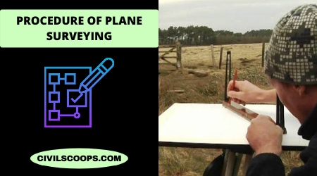
Plane surveying can be accomplished by chain surveying, plane table surveying, compass surveying, theodolite surveying, and levelling.
-
Reconnaissance
Reconnaissance is indeed the initial examination of the region to be chain surveyed. The surveyor examines the region to be measured, surveys it, and then creates an index sketch or main schedule. Move across the whole field and carefully explore the land, noting the location of borders, roads, and rivers, among other things, as well as the numerous complexities to chain lines, pick stations, as well as execute neat sketches such as index sketches or main plans.
- Marking stations
Stations are labeled with ranging rod, or wooden peg, driving a nail or spikes if a hard surface, or embedding stone with a cross mark.
- Reference sketches
After marking, the station should be referenced, i.e., located by a measurement called ties taken from 3 permanent points which are easily identified, such as a corner of the building.
- Running survey line
Following the preliminary work, chaining is initiated from the baseline and is carried out continuously throughout the framework’s lines. As a result, the chain is laid and kept lying, and offsets are taken to locate the nearby details. Make ranging wherever necessary. Measure the change and offset and enter in the field book.
Procedure of Geodetic Surveying
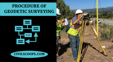
The general method for geodetic surveying is as follows:
- Two station points that are a long distance apart are selected.
- These points’ latitude and longitude are calculated by astronomy.
- The line connecting the two points is known as the base line, and it is precisely determined.
- A third point’s direction is determined by an angle formed with either end of the base line.
- The mechanism results in the formation of a triangle, which is known as triangulation. The operation is repeated until all of the survey land has been mapped.
Use of Plane Surveying

- In general civil engineering survey project job, this term is used.
- Plane surveying employs standard equipment such as a chain, measuring tape, theodolite, and so on.
Use of Geodetic Surveying

- They are used to pinpoint the exact location of a large region that is far away.
- Geodetic surveying employs more accurate instruments and cutting-edge technologies such as GPS.
[note note_color=”#F2F2F2 ” text_color=”#333333″ radius=”3″ class=”” id=””]
Like this post? Share it with your friends!
Suggested Read –
- What Is Traffic Rotaries? | Rotary Intersection | What Is Rotary Island? | Advantages & Disadvantages of Traffic Rotary
- What Is Tie Beam? | Tie Beam Details | Ties in Column | Tie Beam Design | Concrete Tie Beam | Tie Beam Reinforcement Details
- Types of Curing | Concrete Curing Time | How to Cure a New Concrete Slab | What Is Curing of Concrete | How Long Does Concrete Take to Dry | How Long Does It Take for Cement to Dry
- What Is Sheepsfoot Roller? | Characteristics of Sheepsfoot Rollers | Difference Between Padfoot and Sheepsfoot Rollers
- Monolithic Slab I Monolithic Definition I Monolithicfooting I Monolithic Slab Foundationl Monolithic Slab Foundation Design L What Is a Monolithic Slab L How to Form a Monolithic Slab
[/note]
Originally posted 2021-09-28 13:33:57.

