
Post Processed Kinematic (PPK) is a precise and accurate geospatial technology that has revolutionized the way we collect and analyze data. It has become an essential tool in industries such as urban planning, agriculture, land surveying, and environmental management. PPK technology utilizes multiple sources of data, including satellite imagery and ground-based sensors, to generate highly detailed and precise 3D models of the earth’s surface. In this article, we will dive deep into the world of PPK and explore its capabilities, applications, and benefits. Get ready to unravel the mysteries of this cutting-edge technology and discover how it is transforming the way we map and monitor our world.
Table of Contents
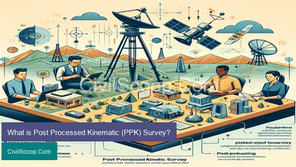
What is Post Processed Kinematic (PPK) Survey?
Post Processed Kinematic (PPK) Survey is a surveying technique that combines both Real-Time Kinematic (RTK) and post-processing methods to achieve highly accurate and precise results. This method is commonly used in the field of civil engineering to capture accurate data for mapping, surveying, and construction purposes.
PPK survey involves the use of specialized equipment such as GNSS (Global Navigation Satellite System) receivers, which are capable of recording and storing precise positional data. The data collected by these receivers is then processed and analyzed after the survey is completed, hence the term “post-processed”.
During a PPK survey, a base station is set up at a known location, and a rover is used to collect data points at the desired location. Both the base station and the rover are equipped with GNSS receivers, which communicate with each other in real-time using radio signals to determine the precise location of the rover.
The rover, which is typically mounted on a pole and held by a surveyor, records its positioning data, including latitude, longitude, and elevation, as it moves along the survey area. These data points are then stored on the receiver and can be downloaded and processed later.
After the survey is completed, the data collected by the rover is transferred to a computer, where it is processed using specialized software. The software compares the rover’s data with the data collected by the base station, which is known to be accurate. Any discrepancies between the two sets of data are corrected, and the corrected data is then used to generate highly accurate survey results.
PPK surveying has several advantages over other surveying methods, such as its ability to capture data in real-time, reduced dependence on a clear line of sight between the base station and the rover, and the potential for greater accuracy, as the data can be corrected and refined during the post-processing stage.
One of the main applications of PPK surveying is in the mapping and surveying of large areas, such as infrastructure projects, construction sites, and environmental assessment. PPK surveys are also used for high-precision measurements, such as monitoring land movements and deformation, as well as for creating detailed topographic maps for urban planning and development.
In conclusion, Post Processed Kinematic (PPK) Survey is a highly accurate and efficient surveying technique that combines both RTK and post-processing methods. It is widely used in civil engineering to capture precise data for various applications, making it an essential tool in the field.
Working of PPK Surveying

PPK (Post-Processed Kinematic) Surveying is a modern surveying technique that combines GPS (Global Positioning System) technology with traditional surveying methods. It allows surveyors to accurately determine the location of points on the Earth’s surface by combining precise positions obtained from GPS satellites with ground-based measurements.
The Working of PPK Surveying involves the following steps:
1. Data Collection: The first step in PPK Surveying is to collect data from both the GPS receiver and the ground-based measurements. A GPS receiver is mounted on a surveying pole and is used to record the location of the survey points. At the same time, ground-based measurements, such as total station and level measurements, are also taken.
2. Post-Processing: Once the data is collected, it is downloaded onto a computer and processed using specialized software. This software combines the GPS coordinates with the ground-based measurements to produce accurate and precise location data.
3. Adjustment: After the post-processing, the data is adjusted to remove any errors or discrepancies. This is usually done by a geodetic expert, who uses advanced mathematical methods to refine the location data and make it more accurate.
4. Verification: Once the data is adjusted, it is verified by comparing it with known control points. These control points are locations that have been previously surveyed and their coordinates are well-documented. By comparing the data with these control points, the accuracy of the PPK Surveying can be verified.
5. Mapping: The final step in PPK Surveying is to produce a map. This map shows the location of all the surveyed points with a high degree of accuracy. This map can then be used for various purposes, such as land development, infrastructure planning, and construction projects.
The main advantage of PPK Surveying is its high level of accuracy and precision. By combining GPS technology with traditional surveying methods, it eliminates most errors and discrepancies associated with each method. This makes it ideal for large-scale surveying projects where accuracy is crucial.
In addition, PPK Surveying is also faster and more efficient compared to traditional surveying methods. With the use of advanced software and equipment, surveyors can collect and process data in a shorter amount of time, saving both time and resources.
In conclusion, PPK Surveying is a highly accurate and efficient surveying technique that has revolutionized the field of civil engineering. It has greatly improved the accuracy and speed of surveying projects, making it an essential tool for modern-day surveyors.
Features of PPK Surveying

PPK (Post Processing Kinematic) Surveying is a surveying method that uses Global Navigation Satellite Systems (GNSS) technology to accurately measure positions and elevations of points on the Earth’s surface. It is widely used in civil engineering projects for mapping, construction, and land surveying. It offers several features that make it a highly efficient and accurate surveying technique.
1. High Accuracy: PPK Surveying uses GNSS signals to determine the precise position of the measurement points. By processing the data collected from multiple satellites, it can achieve centimeter-level accuracy in positioning, which is crucial for civil engineering projects.
2. Fast Data Collection Process: Unlike traditional surveying methods, PPK Surveying does not require setting up physical targets or taking measurements with instruments. The data collection process is automated, and the GNSS receivers can collect data at high rates, resulting in a fast and efficient surveying process.
3. Suitable for Challenging Environments: PPK Surveying can be used in challenging environments such as dense forests, urban areas, and areas with limited accessibility. It can also operate in adverse weather conditions, making it a highly versatile surveying method.
4. Continuous Tracking: PPK Surveying uses multiple satellite signals, which enables it to continuously track the position of the measurement points in real-time. This allows for a more accurate and precise measurement, even when the receiver is moving at high speeds.
5. Cost-effective: Compared to other surveying techniques, PPK Surveying requires less equipment and manpower, making it a cost-effective solution for civil engineering projects.
6. Data Post-Processing: One of the key features of PPK Surveying is its ability to post-process data. This means that the data collected in the field can be processed and corrected afterward, eliminating errors and improving the accuracy of the measurements.
7. High Productivity: PPK Surveying offers high productivity as it eliminates the need for manual measurements and reduces the time spent on data collection. This allows surveyors to cover more area in less time, improving the overall productivity of the project.
8. Easy Integration: PPK Surveying can be easily integrated with other surveying methods such as aerial photogrammetry and LiDAR, allowing for the creation of highly accurate and detailed survey maps.
In conclusion, PPK Surveying is a highly advanced and efficient surveying method that offers high accuracy, fast data collection, and ease of integration with other surveying techniques. Its features make it an ideal choice for civil engineering projects that require precise and reliable data.
Advantages of PPK Surveys

PPK (Post-Processed Kinematic) surveys are a type of surveying method that uses GPS and other satellite positioning technology to accurately measure and map out land areas or structures. This method is widely used in civil engineering for various applications and offers several advantages over traditional surveying methods. The following are some of the main advantages of PPK surveys:
1. Enhanced accuracy and precision: PPK surveys use advanced satellite positioning technology, which offers a high degree of accuracy and precision in measuring and mapping land areas or structures. This makes it an ideal choice for civil engineering projects that require precise and accurate data, such as construction and infrastructure development.
2. Time-saving: PPK surveys are much faster than traditional surveying methods. This is because the use of GPS technology eliminates the need for field measurements and calculations, resulting in a faster and more efficient survey process. This saves time, labor, and costs for civil engineering projects.
3. Cost-effective: PPK surveys are a cost-effective option compared to other surveying methods. As mentioned earlier, the use of GPS technology reduces the need for field measurements, which can be time-consuming and expensive. Additionally, PPK surveys also require fewer personnel, reducing labor costs.
4. Ability to capture large areas: PPK surveys can cover large areas of land in a relatively short period. This makes it an ideal choice for large scale projects, such as highway or railway construction, where the entire stretch needs to be surveyed for design and planning purposes.
5. Non-intrusive: Unlike traditional surveying methods, PPK surveys are non-intrusive, meaning they do not require markers or any physical interference with the land being surveyed. This makes it a suitable option for sensitive areas where minimal disruption is desirable.
6. Adaptable to various terrains: PPK surveys are adaptable to different terrains, including rough or challenging landscapes. This is because satellite positioning technology can be used in remote or difficult-to-access locations, providing accurate data without the need for physically reaching those areas.
7. Data integration and compatibility: PPK surveying technologies are compatible with other software systems, making data integration and management easier for civil engineering projects. This allows for interdisciplinary collaboration and seamless integration with other design and planning programs.
8. Safety and convenience: PPK surveys are conducted from a distance, reducing the risk of accidents or injuries to personnel. Additionally, the use of GPS technology also reduces the need for manual fieldwork, making it a safer and more convenient option for surveyors.
9. Digital records: PPK surveys produce digital records of the land or structure being surveyed. These records are highly accurate and can be used as references for future projects, allowing for improved planning and design processes.
In conclusion, PPK surveys offer several advantages that make them a preferred option for civil engineering projects. These include enhanced accuracy and precision, time and cost savings, non-intrusiveness, adaptability, and safety. With continuous advancements in satellite positioning technology, PPK surveys are expected to become even more efficient and accurate in the future, contributing to the development of the civil engineering industry.
Conclusion
In conclusion, post processed kinematic (PPK) technology has revolutionized the field of surveying and geolocation. Its ability to integrate precise positioning data with aerial imagery has greatly enhanced the accuracy and efficiency of various industries such as agriculture, construction, and land development. Through advanced processing techniques and software tools, PPK allows for highly accurate data collection and analysis, resulting in cost and time savings for businesses. Furthermore, the continuous development and advancements in PPK technology show great promise for the future, making it an essential tool for professionals in various fields. It is evident that PPK has greatly impacted the way we collect, process, and use geospatial data, and will continue to play a significant role in shaping the future of our world