
RTK (Real-Time Kinematic) and PPK (Post-Processing Kinematic) surveying technology have revolutionized the way we collect high-precision data in the surveying and mapping industry. These two techniques have improved the efficiency and accuracy of data collection, making it possible to achieve centimeter-level precision in real-time or post-processing. In this article, we will dive into the world of RTK and PPK technology, exploring their principles, applications, and the benefits they bring to the field of surveying. So, grab your GPS device, and let’s embark on a journey to understand all about RTK and PPK surveying technology.
Table of Contents
Difference Between RTK and PPK Surveying Technology
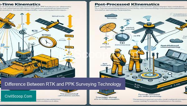
RTK (Real-Time Kinematic) and PPK (Post-Processing Kinematic) are two advanced surveying technologies used for obtaining highly accurate and precise positioning data. Both methods rely on Global Navigation Satellite Systems (GNSS) such as GPS, GLONASS, and Galileo to determine the location of a surveying instrument in the field. However, there are some key differences between RTK and PPK surveying technology in terms of accuracy, efficiency, and data processing.
1. Real-time Data Collection:
As the name suggests, RTK surveying technology provides real-time positioning data. This means that the surveyor can obtain accurate location information instantaneously on-site. The surveying instrument continuously streams data from the GNSS satellites to the base station and the rover, allowing for real-time corrections to be made, resulting in centimeter-level accuracy. On the other hand, PPK surveying technology requires the surveyor to collect data in the field and post-process it later using specialized software to determine precise coordinates.
2. Accuracy:
Both RTK and PPK surveying technology offer high levels of accuracy, with RTK being slightly more accurate. RTK surveys typically have a horizontal accuracy of ±1-2 cm and a vertical accuracy of ±2-3 cm. In contrast, PPK surveys have a horizontal accuracy of ±2-5 cm and a vertical accuracy of ±4-8 cm. This difference in accuracy is due to the real-time corrections and continuous data streaming provided by RTK technology.
3. Data Processing:
In RTK surveying, the data is processed and corrected in real-time by the base station, which sends the corrections to the rover. This reduces the need for complex and time-consuming post-processing, making RTK technology more efficient for time-sensitive applications. PPK surveys need to have data collected in the field and later processed using specialized software, which can be time-consuming and require skilled personnel.
4. Coverage:
RTK technology can cover a larger area compared to PPK as it relies on real-time corrections from a nearby base station. This base station can cover large distances, allowing for larger survey areas to be covered quickly and efficiently. In comparison, PPK technology requires the surveyor to be within a certain distance from the base station for accurate positioning data, limiting the survey area.
5. Cost:
RTK surveying technology is more costly compared to PPK as it requires specialized equipment such as a base station and a rover. Additionally, it requires a subscription to a real-time correction service. PPK technology, on the other hand, only requires a single rover and specialized software for post-processing, making it more cost-effective for smaller projects.
In conclusion, RTK and PPK surveying technology both offer high levels of accuracy and are suitable for different types of surveying applications. RTK is more efficient for real-time data collection and larger survey areas, while PPK is more cost-effective for smaller projects and areas with limited coverage from a base station. Ultimately, the choice between these two technologies depends on the specific needs and requirements of the surveying project.
Conclusion
In conclusion, RTK and PPK surveying technology have revolutionized the field of land surveying. With their high precision measurements and real-time data collection capabilities, these technologies have made surveying more efficient, accurate, and cost-effective. RTK is ideal for applications that require real-time data, while PPK is suitable for post-processing data. Both these technologies have their own unique benefits and are often used in combination to achieve even greater results. With the increasing demand for accurate and rapid land surveying, RTK and PPK are sure to play a significant role in shaping the future of the surveying industry. It is important for surveyors to stay updated with the latest advancements in these technologies and utilize them to their fullest potential in order