Contour intervals play a crucial role in the process of cartography and mapmaking. Found on topographic maps, they provide a visual representation of the earth’s surface and depict elevation and relief. The concept of contour intervals has evolved over time with advancements in technology and changes in mapping techniques. In this article, we will explore the history and evolution of contour intervals, their significance in mapping, and how they are calculated and represented on topographic maps. We will also discuss the different types of contour intervals and their applications in various fields. Understanding contour intervals is essential for anyone working with maps or requiring information about the terrain, and this article aims to provide a comprehensive introduction to this fundamental aspect of cartography.
Table of Contents
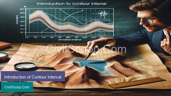
What is Contour Interval
Contour interval is a term used in topographic mapping to describe the vertical distance between each adjacent contour line on a map. These lines represent points of equal elevation on the ground surface and are used to depict the shape and elevation of land features.
The contour interval is determined by the scale of the map and the topographic relief of the area that is being represented. For example, a large-scale map of a steep mountainous region may have a contour interval of 20 feet, whereas a smaller scale map of a flat area may have a contour interval of 10 feet.
The contour interval is important because it helps the map reader understand the degree of slope or steepness of the terrain. The closer the contour lines are to each other, the steeper the slope will be. Conversely, when the contour lines are further apart, it indicates a gradual or gentle slope.
Furthermore, the contour interval allows for accurate measurements of elevation on the map. By using a topographic map with a known contour interval, you can calculate the height of a feature on the ground by counting the number of contour lines between two points and multiplying it by the contour interval.
Contour lines are typically labeled with their elevation at certain points along the line, making it easier for the map reader to determine the exact elevation at a specific location. By using these labeled points, civil engineers can quickly and accurately determine the feasibility of a proposed project in terms of elevation and slope.
In conclusion, contour interval is a crucial aspect of topographic mapping and plays an important role in understanding the shape and elevation of the land. It allows for the visualization and interpretation of the terrain, as well as accurate measurements of elevation. As a civil engineer, having a thorough understanding of contour interval is essential for the planning and execution of projects in various terrains.
Factors Affecting the Selection of Contour Interval
The contour interval is a key aspect in the design and construction of various civil engineering projects, such as highways, buildings, and dams. It refers to the difference in elevation between adjacent contour lines on a topographic map. The selection of the contour interval is influenced by a variety of factors, which must be carefully considered to ensure accurate and efficient design.
1. Scale of the Map: The scale of the map is one of the primary factors that affect the selection of contour interval. A small-scale map covering a large area will require a smaller contour interval to accurately represent the terrain, while a large-scale map of a smaller area can have a larger contour interval.
2. Topography of the Site: The topography of the project site is another important factor in choosing the contour interval. Areas with steep terrain and high relief will require a smaller contour interval to accurately depict the changes in elevation, whereas relatively flat areas can have a larger contour interval.
3. Project Requirements: The type of project being undertaken will also dictate the selection of the contour interval. For instance, highways and dams require a precise and detailed contour interval for accurate design and construction, while less critical projects such as land use planning may allow for a larger contour interval.
4. Accuracy: The desired level of accuracy is another crucial factor in determining the contour interval. Projects requiring high precision, such as surveying and mapping, will have a smaller contour interval compared to projects that can tolerate some degree of error.
5. Available Data: The availability of data also plays a role in setting the contour interval. If detailed topographic data is readily available, a smaller contour interval may be used, whereas projects with limited data may have to work with a larger contour interval.
6. Cost and Time: The selection of the contour interval also depends on the budget and timeline of the project. A smaller contour interval translates to more detailed and time-consuming work, which can inflate the cost of the project.
7. Project Objectives: The primary objective of the project is another crucial consideration in the selection of contour interval. For projects such as flood control or slope stability analysis, a detailed contour interval is necessary to accurately assess potential risks and develop appropriate solutions.
In conclusion, the selection of the contour interval is a critical decision in the design and construction of civil engineering projects. It is essential to consider various factors, including the scale of the map, topography of the site, project requirements, accuracy, available data, cost and time, and project objectives to determine the most suitable and cost-effective contour interval for a given project.
How to Calculate Contour Interval from Maps
Contour intervals are an important feature on topographic maps that help to visualize the elevation changes in the landscape. These intervals show the difference in elevation between contour lines and are essential in understanding the terrain of a specific area. As a civil engineer, it is vital to have the knowledge of how to calculate contour intervals from maps, as it can be used in various engineering applications.
Step 1: Obtain a topographic map
The first step is to obtain a topographic map of the area you want to analyze. These maps can be obtained from government agencies, such as the US Geological Survey, or purchased from commercial mapping companies.
Step 2: Determine the contour interval of the map
The contour interval is usually mentioned on the topographic map, and it represents the vertical distance between each contour line. Typically, the interval is given in feet or meters. If the contour interval is not mentioned, you can measure the distance between two consecutive contour lines and use that as the contour interval.
Step 3: Identify two consecutive contour lines
Next, identify two consecutive contour lines on the map. These lines can be either solid or dashed.
Step 4: Determine the elevation difference between the two contour lines
Using the elevation values mentioned on each contour line, determine the elevation difference between the two lines. For example, if one contour line has an elevation of 100 feet and the next one has an elevation of 150 feet, the difference would be 50 feet.
Step 5: Divide the elevation difference by the number of contour lines in between
The next step is to divide the elevation difference by the number of contour lines in between the two lines. For example, if there are five contour lines between the two lines with a difference of 50 feet, the contour interval would be 10 feet (50 divided by 5).
Step 6: Verify the contour interval
To verify your calculation, you can measure the distance between two other consecutive contour lines and see if it matches the contour interval you calculated. If there are any discrepancies, it is best to recalculate the contour interval or seek assistance from a map expert.
Step 7: Use the calculated contour interval
The calculated contour interval can now be used to determine the elevations of other points on the map. By counting the number of contour lines between a specific point and a known elevation, you can estimate the elevation of that point.
In conclusion, calculating the contour interval from a map is a simple process that involves identifying two contour lines, determining the elevation difference, and dividing it by the number of lines in between. This information can be used in various engineering applications, such as designing roads, drainage systems, and other infrastructure projects. Understanding contour intervals can also aid in identifying potential slope stability issues in a given area.
Uses of Contour Intervals in Surveying
Contour intervals are an important aspect of surveying for civil engineering projects. They are the vertical distance between two adjacent contour lines on a topographic map, representing elevation changes of the terrain. The use of contour intervals in surveying has many benefits and plays a crucial role in the successful completion of construction projects.
1. Topographic Mapping: Contour intervals are used to create topographic maps that accurately represent the three-dimensional surface of the land. These maps are crucial for engineers to understand the terrain and plan the layout of structures, roads, and other features that need to be built.
2. Identification of Slopes: By analyzing the contour lines and their intervals, civil engineers can identify the slope of the land. This information is essential in determining the feasibility of construction and designing appropriate structures to withstand the slope’s angle.
3. Drainage Planning: Contour intervals help to determine the direction of water flow on the land. This information is vital for designing drainage systems, preventing erosion, and maintaining the stability of the land.
4. Cut and Fill Calculations: In construction projects, cut and fill calculations are necessary to determine the amount of earthwork required. Contour intervals assist in accurately calculating the volume of soil that needs to be excavated or added to achieve the desired elevation.
5. Designing Roads: Roads need to be built at a specific grade to ensure proper drainage and stability. Contour intervals help engineers determine the road alignment and the elevation of the road at different points along its length, allowing for a smooth and safe roadway.
6. Environmental Impact Assessment: Contour intervals help in assessing the environmental impact of a construction project. By analyzing the slope, drainage, and topography, engineers can identify potential environmental challenges and incorporate measures to mitigate them.
7. Site Selection: Contour intervals play a vital role in site selection for construction projects. They provide valuable information about the terrain, which helps engineers select the best location for the project, taking into consideration factors such as slope stability, drainage, and accessibility.
8. Land Use Planning: Contour intervals are used in land use planning to determine the best location for buildings, roads, and other structures. This ensures that the construction is suitable for the terrain and minimizes any potential hazards.
In conclusion, contour intervals are an essential tool for civil engineers in surveying and planning construction projects. They provide valuable information about the terrain and aid in determining the best course of action for a safe and successful project. Accurate use of contour intervals can save time, reduce costs, and minimize potential risks during construction.
Conclusion
In conclusion, the introduction and understanding of contour intervals play a crucial role in interpreting topographic maps and understanding the physical features of a specific area. By providing a visual representation of the elevation changes and slope of the land, contour intervals allow us to better plan activities such as hiking, construction, and resource management. They also aid in understanding the formation of natural features such as mountains, valleys, and rivers. It is important to note that the appropriate choice of contour interval depends on the scale of the map and the topography of the area. With the knowledge and skills to read contour intervals, we can gain a deeper appreciation and understanding of the earth’s surface.