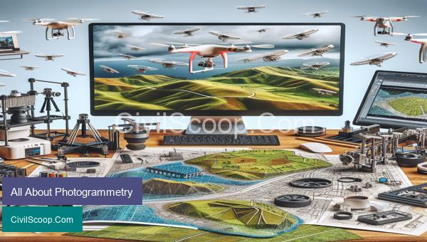
Photogrammetry is a modern and rapidly evolving technology that has revolutionized the field of surveying and mapping. It involves the use of photographs to create accurate and detailed 3D models of objects and landscapes. This technique has a wide range of applications in various industries such as construction, architecture, archaeology, forestry, and even filmmaking. In this article, we will explore the basics of photogrammetry, its various types, and its practical uses in different fields. Whether you are a beginner seeking to understand the fundamentals or a professional looking to expand your knowledge, this article will provide you with a comprehensive overview of all things photogrammetry.
Table of Contents
Terms Used in Aerial Photography
Aerial photography is the process of capturing images from a bird’s eye view through the use of aircraft, drones, or satellites. It is widely used in the field of civil engineering for various purposes such as mapping, surveying, and project development. There are specific terms and techniques used in aerial photography that are important for civil engineers to understand. Here are some of the commonly used terms in aerial photography:
1. Oblique and Vertical Photography: Oblique photography is taken at an angle, while the camera is tilted to one side. This type of photography provides a 3D perspective of the objects captured and is used for visual interpretation and mapping. On the other hand, vertical photography is captured with the camera pointing directly towards the ground, providing a top-down view of the area. It is used for accurate mapping and measurement purposes.
2. Stereoscopic Imagery: Stereoscopic imagery is created by taking two overlapping aerial photographs with a certain amount of displacement between them. When these images are viewed together through a stereoscope, it creates a 3D effect, which helps in the interpretation of the terrain.
3. Orthorectification: Orthorectification is the process of removing the distortion caused by the tilt and curvature of the earth’s surface from an aerial photograph. It results in an image with a consistent scale and does not have any geometric errors. This technique is essential for creating accurate maps and measurements.
4. Scale: Scale in aerial photography refers to the relationship between the distance on the ground and the corresponding distance on the photograph. An image with a scale of 1:10,000 means that one unit on the ground is equal to 10,000 units on the photograph. Understanding scale is crucial for making accurate measurements and creating maps.
5. Ground Control Points (GCPs): GCPs are precise points marked on the ground that are used as reference points in aerial photography. These points are used to correct any distortion in the images. They are essential for creating highly accurate maps and measurements.
6. Digital Elevation Model (DEM): A DEM is a digital representation of the surface topography of an area. It is created by processing the elevation data obtained from aerial photographs through photogrammetry techniques. DEMs are used for various civil engineering applications, such as terrain analysis, flood management, and city planning.
7. Airphoto Mosaics: An airphoto mosaic is created by stitching multiple aerial photographs of the same area together to create a single continuous image. This technique is used to cover larger areas and create highly detailed maps.
8. Georeferencing: Georeferencing is the process of assigning accurate coordinates to an aerial photograph. This allows the image to be placed in its correct location on a map or in a Geographic Information System (GIS). It is essential for creating accurate maps and performing spatial analysis.
In conclusion, aerial photography is an essential tool for civil engineers, and understanding these terms and techniques is crucial for using this technology effectively. With the advancement of remote-sensing technologies, aerial photography has become an integral part of the civil engineering industry, providing engineers with valuable insights and data for various projects.
Procedure of Aerial Photography
Aerial photography is a technique used to capture images of the Earth’s surface from above, typically from an elevated position such as an aircraft, drone, or satellite. It is primarily used by civil engineers to plan and design infrastructure projects, conduct site surveys, monitor construction progress, and generate topographic maps.
The procedure of aerial photography involves several key steps that must be followed in order to obtain accurate and high-quality images.
1. Determine the Purpose and Objectives:
The first step in aerial photography is to identify the purpose and objectives of the project. This will help in selecting the appropriate equipment, flight plan, and image requirements.
2. Select the Aircraft and Camera:
The next step is to choose the aircraft and camera that best suits the project requirements. The aircraft can be a fixed-wing airplane, helicopter, or drone. The camera can be digital or film-based, and its specifications will depend on the desired image resolution.
3. Plan the Flight:
In this step, a flight plan is developed based on the objectives of the project and the desired image coverage. The flight plan includes information such as altitude, flight path, speed, and camera tilt angle.
4. Conduct the Flight:
Once the flight plan is finalized, the aircraft is flown over the designated area to capture the images. Aerial photographers must have a good understanding of flight dynamics and weather conditions to obtain clear and stable images.
5. Process the Images:
After the flight, the captured images are processed to remove any distortions caused by the camera or the aircraft movement. This includes correcting for lens distortion, image stitching, and color balancing.
6. Georeference the Images:
Georeferencing involves assigning geographical coordinates to each image, which enables the images to be accurately placed on a map. This involves referencing the images to known ground control points on the Earth’s surface.
7. Create the Final Product:
The final step is to create the desired product, which can be a map, 3D model, or orthophoto (geometrically corrected aerial image). The product can be created using a variety of software such as GIS, CAD, or photogrammetry software.
Aerial photography has revolutionized the way civil engineering projects are planned, designed, and monitored. It provides engineers with a detailed visualization of the project area and helps them make accurate and informed decisions. By following the above procedure, engineers can obtain high-quality aerial images that are essential for successful project completion.
Conclusion
In conclusion, photogrammetry is a powerful technology that has revolutionized the way we capture, analyze, and interpret spatial data. Its applications range from archaeology and urban planning to engineering and environmental monitoring. With the advent of advanced software and hardware, photogrammetry has become more accessible and cost-effective, making it an essential tool for many industries and disciplines. However, like any technology, it has its limitations and challenges, such as accuracy and data processing. As the technology continues to evolve, it is important to stay informed and updated on its developments and advancements. With its ability to create detailed and precise 3D models from simple photographs, photogrammetry will undoubtedly continue to play an essential role in various fields, pushing the boundaries of what